BLUE TRAIL 18: CARLOTTA ARCH, Jenolan Caves

Many of the Jenolan visitors who begin their caves walking excursion from the overflow carpark will pause to admire the majestic Carlotta Arch and the view through it to the Blue Lake, far below. 

Carlotta Adams was the daughter of PF Adams who surveyed the Devil’s Coachhouse, another spectacular open cave. The sides of this natural arch contain hints of the abundance of “stalactite” formations the visitor can expect on a guided cave tour.

Visitors gaze through Carlotta Arch at the Blue Lake
[photo: © (Geoff Dernee]
The range of birds, reptiles and insects frequenting the nooks and crannies of the open caves and their surrounds is naturally much more diverse than is the case with the underground caves. 

The unique blue of the lake, so often framed by Carlotta Arch in photographs, is caused by the dissolution of limestone in the chilly waters flowing through some of the underground caves. In recent years, a platypus family has been noticed residing in the lake. 

© Don Morison
BLUE TRAIL 17: Around Londonderry Reserve, River Lett Catchment

The River Lett received its name when someone reading the 1814 survey notes made by Surveyor George W Evans did not pick up that he’d intended to write the word “rivulet”. It is a relatively short waterway with an eclectic series of landscapes along its course. 

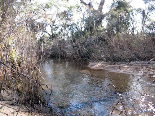
Reeds by Londonderry Reserve
[photo © Christine Davies]
In an accessible section, motor traffic crosses the Joseph Morris bridge, named after a local pioneer whose descendant, Barry Morris, was an apple grower who became Liberal State MP for the Blue Mountains until disendorsed due to a court case involving “joke” phone calls made in theatrical voices. 

A few hundred metres downstream, the waterway filters lazily through a bed of reeds along the boundary of the Londonderry Reserve. Nearby is a property owned by the children of a woman who kept emus raised from chicks brought from Cobar. 

An emu interprets Mount York for visitors to the River Lett catchment [photo © Christine Davies]
The surviving emus often greet visitors who pull off the road near Londonderry Reserve to admire the birds and the excellent view of Mount York (where the three explorers, whose tracks Surveyor Evans was following, realised in 1813 that they had crossed the mountains into a new landscape). 

© Don Morison

Blue Trail 15: Stile Country, Central Megalong Creek Catchment

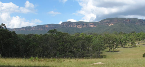
Narrowneck cliff-face and clouds from Six Foot Track (photo: Christine Davies)

The “Six Foot Track” was a bridle track cut in 1884 to a specified width to allow tourist horse riders between Katoomba and Jenolan Caves. Now it is one of the most popular of the longer walks in the Greater Blue Mountains. 

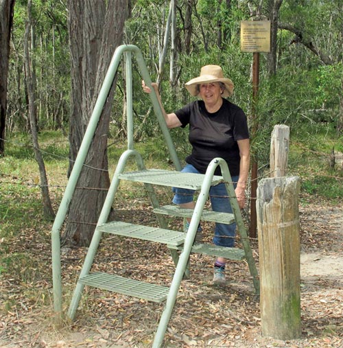
Where it crosses private property, east of Megalong cemetery, a series of stiles take walkers across the fence lines. The lack of cars and off-road vehicles make this one of the most attractive sections of the track. Eastern Grey Kangaroos and various wallaby species are often seen. Many old trees have been left undisturbed on these agricultural lands, including large Angophora floribunda, Eucalyptus punctata and other species of the Myrtaceae family. 

A woman with stile (photo: Don Morison)

The countryside undulates gently. The going for walkers is fairly easy except when substantial rains turn the normally tame watercourses into frothing torrents. The mixture of agricultural land and woodlands attracts a variety of birds including flocks of White-winged Choughs. 

This trail section is one of the best vantage points to view the unspoilt cliffs of Narrowneck Plateau, a short distance to the south.

© Don Morison