Scattered through the bushland on the eastern escarpment of the Blue Mountains of New South Wales are many reminders of the past. Not all are as visibly obvious in the landscape or as meaningful as the towering, seven-arched, sandstone viaduct across Knapsack Gully or the convict built, sandstone Lennox Bridge over Brookside Creek. The locations of the innumerable, indigenous sites are less well known too. And unfortunately their significance is not widely understood either. For many reasons, a lot of evidence from the past has not survived the years or is in varying stages of destruction.
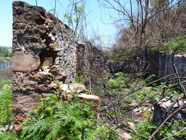
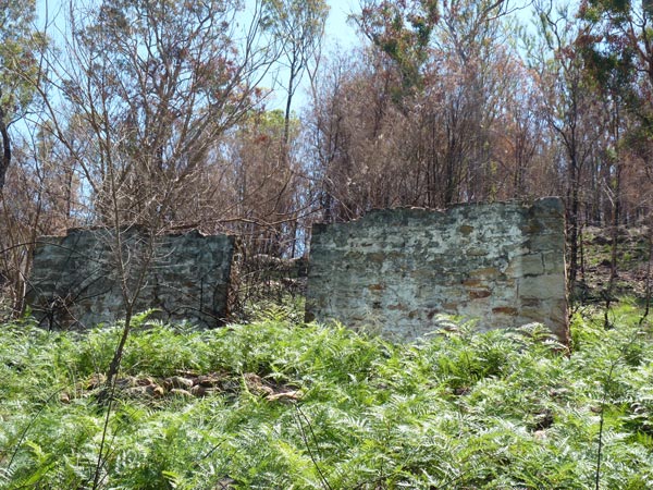
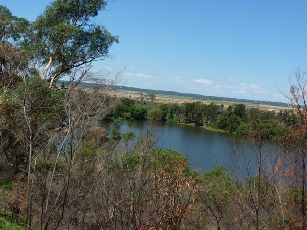
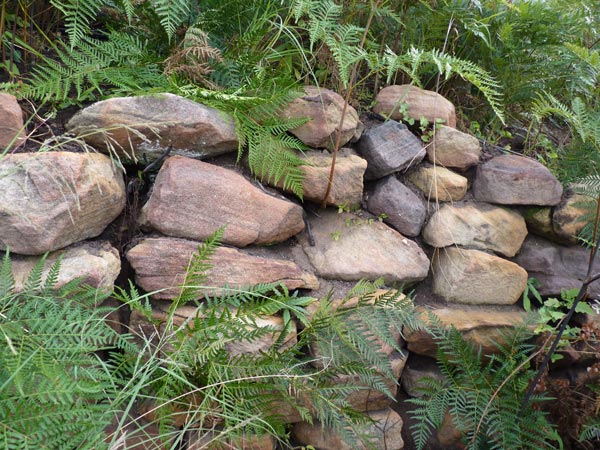
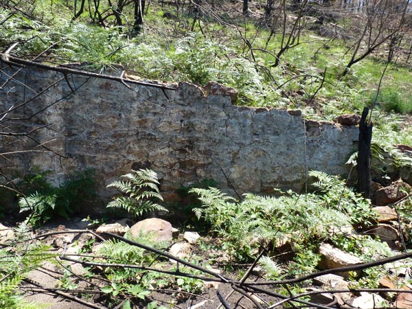
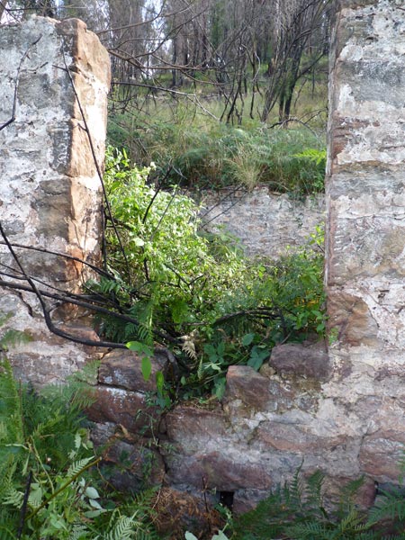
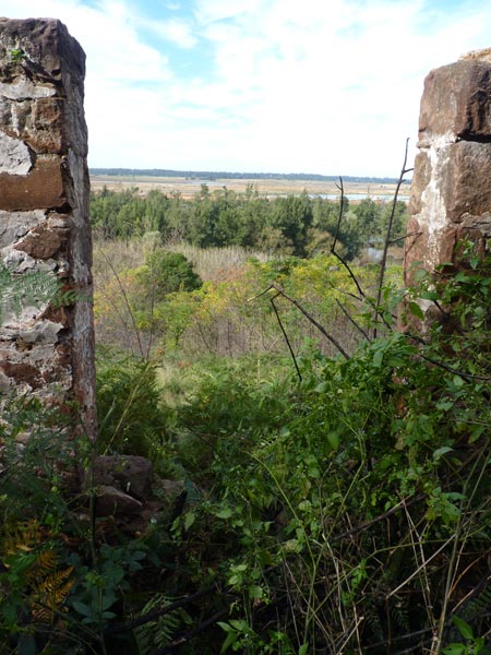
The ruins of what was known as ‘the white house’ are such an example. They comprise four, once white-washed walls, made of a composite, stone construction. The ruins are all that is now left of a two storey house built on the western side of the Nepean River, on the escarpment below Singles Ridge and directly opposite the Upper Castlereagh area. Although a modest, unpretentious structure, for many locals the white house became a familiar reference point on the escarpment. As well as highlighting its position in the bush landscape, the house’s whitish colouring seemed also to emphasize its lonely isolation.

For many years I have lived within walking distance of the white house ruins, unaware of their existence. On hearing about the white house a year ago, my curiosity was roused to go in search of the ruins and their hidden history.
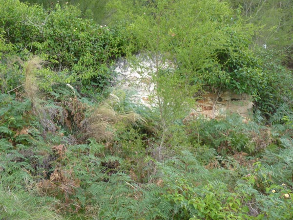
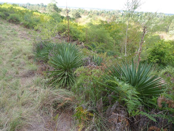
But finding the ruins was easier said than done. The thick covering of lantana, blackberry and other assorted weeds and thorny vines that greeted me in May last year (2013), made their finding difficult.
From the arrival of Europeans to present times, the region where the white house ruins are appears to have been somewhat difficult to develop and manage. Originally part of the Colo Shire, since 2000 the area is now part of the 485 hectare Yellomundee Regional Park controlled by NSW National Parks and Wildlife Service.
This area was first sighted by Europeans in late June 1789, the second year of their arrival in the colony they named New South Wales. Watkin Tench, a Captain Lieutenant in the marine corps, led a party from Rose Hill, exploring the land to the west. The group came upon an impressive river which Governor Phillip later named the Nepean. With considerable difficulty caused by the undergrowth, they followed it upstream. The capacity of this river to flood severely did not escape Tench’s attention. Despite being some 12 metres above the river level, he noted that there was still definite signs that the land had recently been flooded. He also saw plenty of evidence of indigenous life around the river, including huts, cut marks on trees, two canoes and some animal traps. In his account of this short, exploratory trip, Tench concluded that the country was a lonely, intimidating and unfamiliar place, full perhaps of hidden dangers.
The Windsor and Richmond Gazette (2 July 1910) reported that in June 1910 Thomas Galvin and his wife Mercy (nee Selby) appealed against the unimproved, assessed value of their two adjoining properties (40 and 36 1/4 acres) fronting the western side of the Nepean River at Castlereagh. Galvin was a carpenter and builder. He was one of the first builders to work on St Stephen’s Church steeple at Newtown. Their 40 acre property happens to be the one where the white house ruins are.
Land value was based on the productivity and therefore profitability of each block. Galvin argued that there was a predominance of ‘rocks, gullies and mountains’ and insufficient grass land on both his blocks. Although the river flat could be cultivated, it was subject to flooding.
School teacher Arthur Street was appointed to Penrith Public School in May 1938. He said ‘in later years’ he became interested in the history of the Nepean Valley. ‘Now and again,’ he wrote, ‘something mysterious or intriguing would present itself. Such was The White House.’ When he first took students on an excursion there, ‘there were four walls left of a cottage, garden beds and some lime trees’. The walls ‘were painted white and visible for miles.’ The date of this excursion is not given. In 1967 his interest was roused again when he noticed ‘the disappearance of the familiar landmark’. Street asked his students if they knew anything about the building. He received a letter from student Peter Jackson’s grandfather, Cecil, who as a child had lived in the white house with his family. Despite renewing his interest and his subsequent retirement in 1973, Street apparently did not return to the white house ruins until early in 1984. This visit, with some members of his Local History Evening Class, resulted in his self-published booklet about the white house of the same year.
Included in Street’s booklet is Cecil Jackson’s informative letter about white house life, written in1967. The following account of life at the white house between 1916 and 1922 comes from information contained in that letter. I have also used information from interviews with Cecil’s sister Helene, also known as Nellie, and brother John, conducted by Street and also included in his booklet. Nellie’s married name was McManus and when interviewed she was living in Penrith. No date is given for the interview. However, it took place about 15 years after Street received Cecil’s letter, so that would date it in the early 1980s. On 16 May 1984 Street also interviewed John (Jack) Jackson who was living at Emu Plains. Born on 3 June, 1906, he was just about to turn 78.
The Jackson family had been living on a farm in Jackson’s Lane, Castlereagh. All the children were born there. The farm was opposite another farm where their grandparents lived. Nellie believed that both farms were rented. In 1916 their father rented Tom Galvin’s white house farm for five years. The family comprised John Thomas and Eva (nee Wright) Jackson, their four sons and three daughters.
From the outset, Cecil Jackson said that his family always referred to the building which they lived in on the farm as ‘the white house’. According to John the real name of the white house was Oakley.
The children ‘had a lot of hard work to do there’ but they also had ‘a lot of fun’. Jobs were done before and after school and on the week-end. These included milking the cows and feeding the calves. If there was insufficient grass for the cows and horses to eat, the children would climb and cut branches from the oak trees for feed. All the children helped with the collection of water from the river. They used a wooden yoke to carry the water in two kerosine tins. They also helped look after the vegetable garden. Some of the water collected was used on this garden. They grew tomatoes, cabbages and melons, as well as fruit trees. Their father also grew tobacco plants.
One of John’s jobs was to collect fire wood from the bush. Sometimes the girls collected the kindling. John was also responsible for locking the fowls up each night to protect them from foxes. Their father also set traps for dingoes.
Each Saturday morning Cecil remembered crossing the Nepean River with a horse and cart and travelling into Penrith to do the weekly shopping.
During most summer’s, fire-breaks had to be burnt around the house in preparation for any bush fires. ‘We always burnt the fire-breaks at night,’ Cecil recalled, ‘and really enjoyed doing it.’ Nellie recalled how the burning of the fire-breaks would ‘send the snakes amongst us and down to the river. Sometimes they would pass between our legs – they were so frightened.’ John remembered Tom Galvin sometimes coming to help the family defend the white house against the bush fires. According to John, he lived in the house below them.
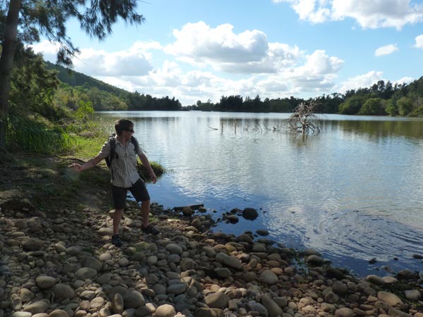
The river obviously played a very important part in their daily lives. As well as contributing positively, it could also inconvenience their lives at the white house and also at times pose real danger. One year the river flooded greatly and drowned their sows and piglets. John recalled the time when their mother nearly drowned while crossing the river. It was around midnight and she was returning home after helping a sick relative at Castlereagh.
After the war, the world was again affected by another tragic, life threatening event in the form of the pneumonic influenza epidemic. Despite its geographic isolation, Australia was not spared the epidemic in 1919. And the isolated position of the white house provided no protection for the Jackson family either, their father soon catching the disease. However, their mother again showed her nursing ability, successfully restoring him back to health.
The family attended the Wesleyan Church at Upper Castlereagh every Sunday. John remembers his father being ‘very strict about church attendance.’
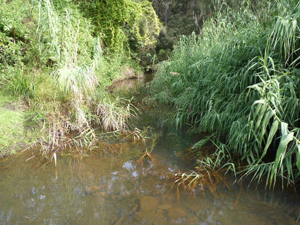
Leisure time pursuits included catching rabbits and sometimes snakes, swimming, mountain climbing, exploring caves and rolling rocks into gullies. They also enjoyed making boats and rafts to float on the river. There was no work on a Sunday after church, so a regular, weekend treat was a picnic in Field’s Gully, where Fitzgerald Creek flows into the Nepean. ‘It was lovely and cool in the summer time,’ Cecil remembered, ‘with a little stream trickling down the mountain and forming little clear pools from which we caught crayfish.’ Their mother would cook a fowl to take with them.
After five years living at the white house, the family rented a house owned by Sim Walker. Called Glenelg, it was situated on the Western Highway at Emu Plains. Cecil summed up the family’s five years at the white house by saying:
‘…we all had a happy and interesting life there, even though it was a bit out of the way.’ Nellie agreed: ‘We worked hard but we were happy.’ And according to John, they were all sad when the time came to leave the white house. ‘…It was a hard life and away from everyone else.’
In his letter Cecil made reference to the burning down of the white house during a bushfire ‘a few years ago’. He said that it left only the stone walls standing. A letter from Dorothy Dengate, dated 2 August 2001, was published in the Field Family Newsletter, 7th Edition. She recalled her childhood at Emu Plains and catching rabbits in Field’s Gully. She also inquired about a house near there which she thought possibly belonged to Edward Field. ‘The house was two stories (sic),’ she continued, ‘and had a veranda top and bottom, it was falling down then and we were never aloud (sic) to go into it. It would have been about 1940 – 43.’ It sounds like she was describing the white house. If that is so, the white house was still there but uninhabited. The Sydney Morning Herald’s front page on 8 December 1951 gave an account of a bushfire that destroyed homes on the Lower Blue Mountains. Under the headline ‘Nepean River Homes Threatened By Flames’, there is a photograph of a house that could possibly have been the white house. In the photograph, the fire front is very close to the house. I wonder if this was the fire to which Cecil was referring.

In Street’s booklet there is a sketch of the white house compiled by Arthur Street, George Gyford and Jack (John) Jackson. Street refers to a ‘snap taken about 1920’ and also reproduced in the booklet. However, the quality of the reproduction is poor and does not assist in corroborating the sketch.
The sketch shows the white house to be a two storey building with a fibro room extension off the northern wall of the bottom room. This extension has a small front window and a fireplace, as there is a chimney, possibly of iron, at its side. The extension was more than likely used as the kitchen.
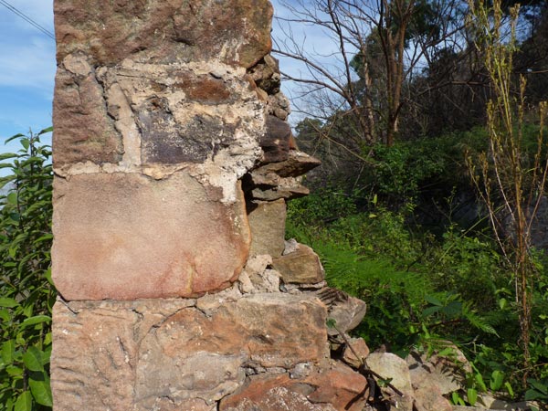
Although grateful for all the wonderful information included in Arthur Street’s booklet, as the above inconsistencies in the sketches reveal, there are still many questions unanswered about the white house. There is uncertainty regarding the date when the white house was actually built. Reginald Galvin said that his grandfather bought the 20 acre property and home from Mr McCann. The fact that he said there was already a home on the land differs from Tom Galvin’s own evidence at the appeals court in 1910. There is also an error in Reginald’s recall of the actual size of the block. His grandfather stated that it was 40 acres in size and the Parish Map also shows this to be the case. After purchasing the land, Tom Galvin stated that he set about building a home on it.
No mention is made by him of any other dwelling on the block. And if there had been a house already there, was this the white house or a part of it? Or could it have been the smaller house Reginald drew to the right of the white house and closer to the river? Nellie Jackson remembered that house being there while her family resided at the white house. She referred to it as ‘the house down below’, however, she did not say whether it was occupied. Perhaps this was where Tom Galvin lived for a while, as remembered by John Jackson. It seems to have been only a temporary or weekend residence for Galvin. He had moved to Doonmore Street, Penrith in early 1920. In an article in the Nepean Times (27 March 1920), he complained about Doonmore Street’s inadequate lighting.
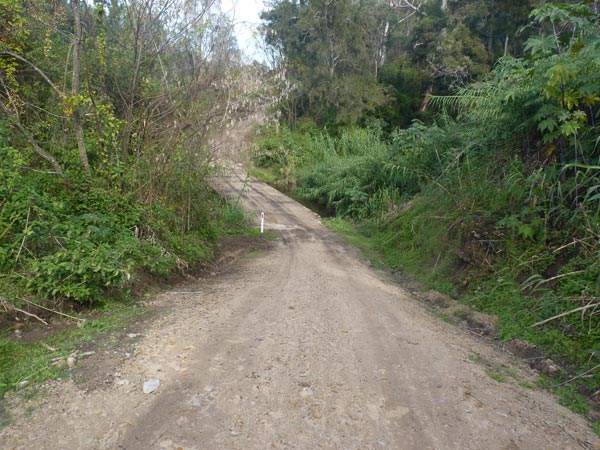
A study of the white house highlights the importance of the Nepean River’s influence on life along its western bank. It provided a convenient source of water for domestic usage. It meant that families like the Jacksons could successfully supplement their food supply by growing vegetables and fruit trees, keeping animals and fishing. The river and its creeks also contributed to the quality of leisure time activities. However, the river had considerable, negative impacts on life there. Its regular flooding was life threatening, occasioned much inconvenience by isolating people and did untold damage to low lying land activity and property.
There was a definite sense of isolation and inconvenience experienced by those living on the western bank. But this seemed to assist in contributing towards the family members’ sense of reliance on each other and the responsibilities that entailed. Floods and bush fires further brought the family members closer as they sought to maintain a hard but happy existence.

© Jim Low July 2014
note:
If you know anything about the White House Jim would love to hear from you.
email: jim@jimlow.net
